Tuesday, August 29, 2017

August 27 - Mount Baker National Recreation Area

Railroad Grade Trail

Total Miles: 7
Elevation Gain: 2,000 feet
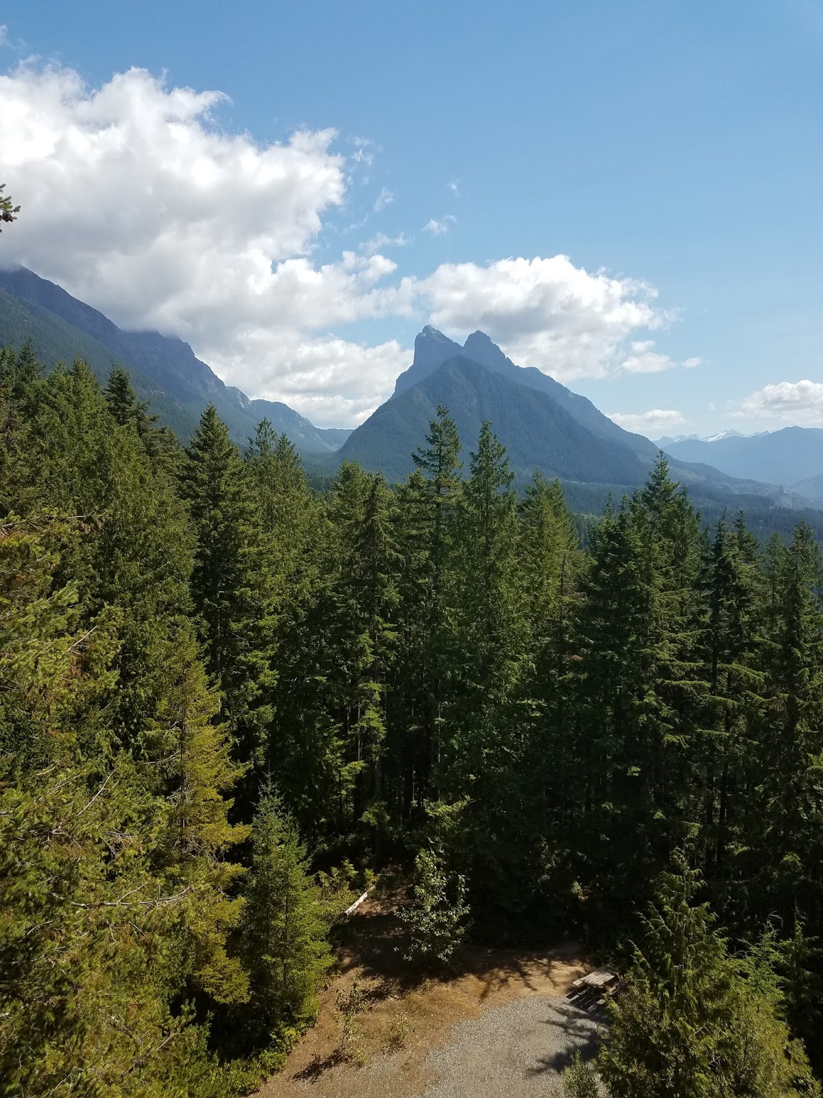
Highlights: up-close views of Mt. Baker, wildflowers, marmots
More information: http://www.wta.org/go-hiking/hikes/railroad-grade


Sunday was my final shift as a volunteer Mountain Steward for this summer.  I was stationed with another volunteer in the Mt. Baker National Recreation Area, as I often am.  By now, I have hiked this trail system dozens of times.  However, today's hike was quite memorable for several reasons.

First of all, it was HOT from the get-go.  Usually, even on warm days, things start out cool and gradually warm up, but it was noticeably warm from the moment we got out of the car.  In fact, the other volunteer and I both ran out of water before finishing the hike.  We were about a half mile from the car when I ran out of water in my pack, which was no big deal because I had a big bottle in the car, but that means I went through three liters of water during the day.  I have NEVER run out of water before, even on hikes much more strenuous than this.  


Secondly, we crossed paths with an official Forest Service ranger who was hiking up the trail before setting up a little information table at the trailhead.  She was hiking in uniform but with no backpack, no food, and no water.  She had her radio in one hand and her cell phone and keys in her pocket.  That was it.  She asked us if she could have a few sips of our water before heading back down.  She was not setting a very good example for other hikers on the trail.


Finally, as we were returning to the trailhead, we came around a bend in the trail to see an older gentleman falling over and his hiking partner trying to keep him from tumbling over the downhill side of the trail.  We were able to help get him seated on the trail and get some food and water in him, and before long he was able to start making his way down the trail again (very slowly).  The other volunteer Mountain Steward I was working with is a flight attendant, so she has had some extra medical training and was able to take the lead in handling the situation.  My basic first aid skills just weren't cutting it when it came to dealing with a guy who had a number of health issues and was most likely suffering from some level of heat exhaustion.  In the end everything worked out just fine, but it's the closest I've ever come to having to actually use my radio for more than just check-ins.  


All in all, it was still a really nice day of hiking with perfectly clear skies, some wildflowers still blooming, and several marmot sightings.  

Hike-A-Thon ends in just a few days.  Make a donation now!

Mom and Dad, thanks for your donation!

Friday, August 25, 2017

August 24 - Green Mountain Lookout

Green Mountain Trail

Total Miles: 8.5
Elevation Gain: 3,300 feet
Highlights: Historic fire lookout, wildflowers, expansive views, tarns, meadows, berries
More information: http://www.wta.org/go-hiking/hikes/green-mountain


The trek to Green Mountain Lookout was on the list of hikes I wanted to tackle last year during Hike-A-Thon.  In fact, I was scheduled to go up to the lookout as a volunteer Green Mountain Steward over Labor Day weekend, but the weather called for severe thunderstorms, heavy rain, and temperatures in the 30s so that trip was a no-go.  

Since last year's trip was a bust, I made it a priority to get to the lookout this summer, and yesterday was the day.  The drive to the trailhead was long and rough, taking much longer than I expected.  However, the trail itself was less steep than I anticipated.  I was mentally prepared for the entire trail to be really steep from the get-go, so I was pleasantly surprised when it was not.   

The trail starts out climbing gently through the forest before breaking out of the trees onto a huge meadow-filled slope.  Here the trail was getting seriously overgrown, and some of the vegetation was up to my shoulders, but the trail still wasn't very steep.  Instead, the trail made long, sweeping switchbacks up through the meadows that, unfortunately, were past peak wildflower stage.  

Fall has already arrived along some sections of the trail.

After a couple of miles, the trail drops down a bit into a basin with a couple of tarns and campsites as well as lots of ripe blueberries.  I forced myself to take a break here and eat a snack.  I rarely take breaks when hiking, but I knew the last mile to the lookout was going to be steep so I needed to fuel up.

The lookout tower is on the top of the ridge at the very center, 1300 feet above my break spot.

The final mile to the lookout climbs 1,300 feet in about 1 mile.  The trail was incredibly dusty because of the dry weather this summer and fully exposed to the sun.  Today was party cloudy with a nice breeze which made for perfect climbing weather.  Hiking this trail on a hot day would be brutal.  

A few wildflowers were still blooming, but most were going to seed like this Western Anemone (or as I like to call it "The Lorax Flower"

After passing a bear hunter and a family of grouse, I made it to the summit ridge. 

Grouse family
Approaching the lookout
Even closer

Made it! (sitting on the lookout steps looking out at the ridge I just came up)

I had the lookout deck all to myself (The lookout tower itself is locked shut because it houses Forest service radio equipment.) while I ate lunch and watched the clouds float by. At one point, I was basically in a cloud.


Within 10 minutes of descending from the lookout, I passed three other groups of people headed up.  They were the only other people I saw all day, and I was lucky to be ahead of them on trail so I didn't have to share the lookout with anyone.

On the way down, I passed another grouse sitting on a dead branch as still as it possibly could as it tried to fool me into thinking it wasn't really there.  I wasn't fooled.

Grouse on a branch
As I continued down, the clouds cleared a little bit, so I got a better view of the surrounding mountains, but Glacier Peak remained hidden all day.  I'll just have to come back another time to see the full 360-degree views.

Looking down into the Suiattle River valley
Please help support the work of WTA by clicking here!

Monday, August 21, 2017

August 20 - Mt. Baker National Recreation Area

Park Butte Trail

Total Miles: 7.5
Elevation Gain: 2,200 feet
Highlights: Meadows, wildflowers, berries, views of Mt. Baker, historic fire lookout


Sunday was my second shift as a volunteer Mountain Steward this summer.  Last time, I was on the Skyline Divide trail on the north side of Mount Baker, and this time I was on the Park Butte Trail on the south side of the volcano.  Overall, I crossed paths with 133 people on the trail and chatted with 45 of them.  


It was a nice day weather wise - mostly sunny, not too hot, a pleasant breeze.  Unfortunately, a lenticular cloud obscured the summit of Mount Baker the entire day.  I did learn that a lenticular cloud typically indicates a change in weather is coming in the next 24 hours.  However, it's been 24 hours since the hike and the weather has not changed.  


There were still a few wildflowers blooming in the upper meadows and the blueberries in the lower meadows were very close to being ripe - a bit tart still so I didn't pick any.  I could hear several pika in the rock fields, but could never catch a glimpse of one.  They are very quick, sneaky creatures.  I will be back on this same trail next weekend for my final Mountain Steward shift of the summer, so maybe I'll get lucky and see a pika then.

WTA has made a lot of improvements to this trail over the years.  They have had work parties along the Park Butte Trail pretty much every summer that I have been a volunteer Mountain Steward.  That work wouldn't be possible without donations, so please consider sponsoring my Hike-A-Thon campaign by visiting my fundraising site.  

Saturday, August 19, 2017

August 19 - Heybrook Lookout

Heybrook Lookout Trail

Total Miles: 2.6
Elevation Gain: 850 feet
Highlights: Excellent views, well-maintained trail, interesting lookout tower
More information: http://www.wta.org/go-hiking/hikes/heybrook-lookout


It was a nice day (not too hot) with clear skies, so it was the perfect time to make a quick trip up Highway 2 to Heybrook Lookout.  For a Saturday afternoon, the trail was not that busy, and I even lucked out and had the lookout platform to myself while I ate my lunch.  There were just enough clouds in the sky to keep photos interesting without obscuring any of the mountain peaks.  

Tomorrow, I have a Mountain Steward shift, so the short, yet moderately steep, trail to Heybrook Lookout was a good warm-up for the miles I'll be getting in then. 


Everyone loves some Simpsons artwork.
Help me raise money for Washington Trails Association by clicking here!

Thursday, August 17, 2017

August 17 - Ebey Waterfront

Ebey Waterfront Trail

Total miles: 2.6
Elevation gain: 106 feet
Highlights: birding opportunities, easy access
More information: https://www.wta.org/go-hiking/trip-reports/trip_report.2017-04-22.5362858819


This morning I went to check out this newly-built trail in Marysville.  The trail was completed in April of this year and runs for 1.3 miles along the shore of Ebey Slough and through the Qwuloolt Estuary.  

It was a nice enough place to take a walk and only about 10 minutes from my house, but it is certainly not much of a wilderness experience.  The trail is sandwiched between the slough and a water treatment plant.  Interstate 5 is in view much of the way, although the traffic noise was significantly less than I expected.  Despite the ever-present human-made elements, there are some good opportunities for bird-watching along the trail.  I saw two herons, some ducks, and a few other birds that I recognized but can't think of their name.


The last third mile or so of the trail veers away from the water treatment plant and would have some nice mountain views on a clear day.  


Please make a donation to my Hike-A-Thon campaign by clicking here!

Tuesday, August 15, 2017

August 12 - Big Four Ice Caves

Big Four Ice Caves Trail

Total Miles: 2.2
Elevation Gain: 220 feet
Highlights: A lot of variety in a short trail, formation of ice caves and history of area is interesting, nice views of surrounding mountains
More information: http://www.wta.org/go-hiking/hikes/big-four-ice-caves

Over the weekend, I went camping at Red Bridge Campground on the Mountain Loop Highway.  Though I spent most of the time cooling off in the river, sitting around the campfire, spelunking in Black Chief mine, and whipping up some delicious camp meals, I did squeeze in a couple of Hike-A-Thon miles.  


The trail to the Big Four Ice Caves is about 7 miles from the campground and was naturally a very busy place on a sunny summer afternoon.  Even though it sometimes felt like I was walking down a sidewalk in the city with how many people were on the trail, there was plenty of space to spread out at the end of the trail.  The caves themselves were pretty big, and of course there were people ignoring all of the signs along the trail warning you to stay out of the caves, but that is to be expected here.  I just enjoyed the cool breeze blowing over the snow before returning to camp to grill up some burgers over the fire.


Please support my Hike-A-Thon campaign by donating here

A big thank you to Grandma Jeanne, Grandma Sylvia, Chris & Kim, and Mike & Annette for your donations!

Monday, August 7, 2017

August 5 - Hope and Mig Lakes

Tunnel Creek Trail to Hope and Mig Lakes

Route: Tunnel Creek Trail → Pacific Crest Trail (north)
Total Miles: 5.2
Elevation Gain: 1,550 feet
Highlights: Two nice lakes, lots of berries, descent views, good campsites
More information: http://www.wta.org/go-hiking/hikes/mig-lake

Saturday I was scheduled for a Mountain Steward shift on the trails at the Mt. Baker National Recreation Area.  Friday evening, just as I was getting my gear ready for that outing, I got a call that our shifts were being canceled on account of the heat and unhealthy smoke conditions.  The Mountain Steward coordinator is always overly cautious about sending Stewards out in anything less than ideal conditions, and they like to play it safe when we're under the liability of the U.S. Forest Service. (I wasn't too disappointed because a couple of years ago I did a Mountain Steward shift on a really smokey day and my throat was sore and scratchy for a few weeks afterwards.)

At any rate, I needed to make some alternate hiking plans since I couldn't miss out on hitting the trails on Washington Trails Day.  I checked out a radar map showing the smoke concentrations and decided on a hike in the Highway 2 corridor.  Then I perused the WTA hiking guide and settled on a trip to Hope and Mig Lakes, two small lakes near Steven's Pass that I had not been to before.  

The Tunnel Creek Trailhead is just over a mile off of Highway 2, a few miles before the ski area.  I was surprised to find 12 cars at the small trailhead when I arrived and some not parked very courteously which made it hard for other vehicles to come and go.   The trail climbs up through a valley, and on this particular morning, the valley was filled with super stagnant, muggy air.  It was still pretty early and not that warm out, but I was sweating quite a bit.  

Once I got out of that valley and reached the first lake, the air was much more pleasant.  From Hope Lake, I turned north on the Pacific Crest Trail for under a mile until I reached Mig Lake.  I found an unoccupied campsite on the shore of the lake which was a perfect spot for enjoying my snack and taking in the views.  (Note:This trail has some nice views of surrounding mountains at times, but they aren't spectacular or of any noteworthy peaks, which was part of the reason I chose this trail on a hazy, smokey day.)

After my break, I headed back down the trail and was looking forward to making a quick pit stop at Deception Falls on the way back home.  But then, as I was getting in my car, I dropped my phone.  The screen shattered and wouldn't work anymore. I was funky so I just came home without stopping at the falls.  I am still figuring out a new phone situation and haven't been able to retrieve the photos off of my broken phone yet, so that's why there are no photos accompanying this blog entry.  You can always use your imagination or search Google images if you want to know what these two quaint lakes look like.  

Cheer me up over the loss of my phone by making a donation to my Hike-A-Thon campaign!